I am adding to a canon here. The Swaledale Corpse path, which runs along the Swaledale Valley in the Yorkshire Dales from the area of Keld to Grinton, is already well blogged about – see here, here and here for just three examples. Probably because of this, it’s one I have wanted to do for a long time, and this week I got my chance. The story is the same as elsewhere: before the church at Muker was built, the deceased had to be carried up Swaledale for burial at St Andrew’s Church, Grinton. As denoted by the blogs, this path seems to have attracted particular interest and tales – including the the haunting of Ivelet Bridge by a headless black dog which was, it seems, a portent of death.

I set off from Frith Lodge, a fabulous B&B a little north of Keld (just off the Pennine Way – very warmly recommended, Neil and Karen are perfect hosts). One needs to cut down and cross the river to get to the start of the walk, but this leads through the pleasant Rivendell-like landscapes of East Gill Force – all granite waterfalls and the swirling, beer-brown water of the Swale – to the notional start of the walk in Keld.

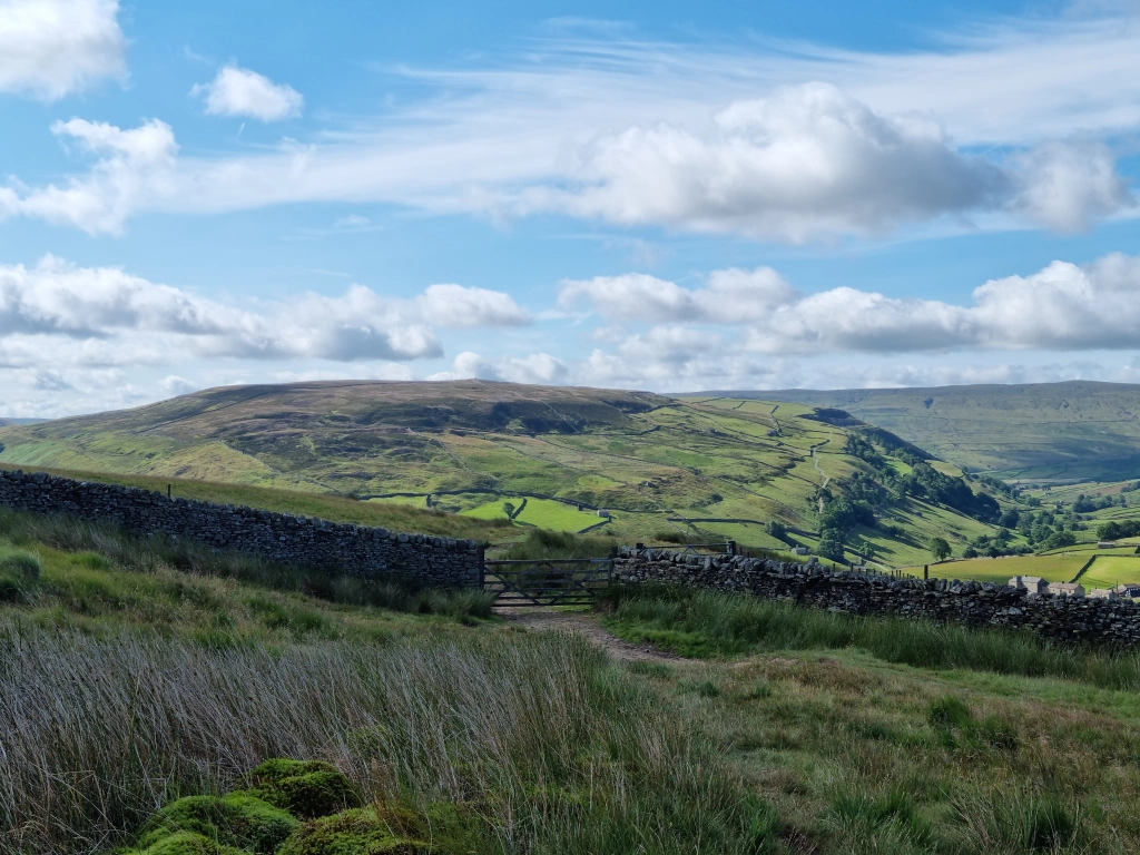
Swaledale from Kisdon Fell
Here, the corpse path briefly overlaps with the Pennine Way, which my late father walked in 1978. In the diary he kept, he said of this section:
After the steep climb to Shunner [Fell, to the south] I wanted a rest and a smoke, so [his walking companions] went on again soon disappearing into the most ferocious gale we’d so far experienced. The cloud was racing by at 70 to 80 mph and you had to lean hard over to keep you balance. Cairns, which had seemed ridiculously close when we’d crossed Shunner in fine weather were now a vital supplement to the track of earlier boot-prints. The wind roared by like an express train in a tunnel – an invisible though powerful presence. I started singing a marching song.
The next day however, the weather had looked up:
I climbed up to Keld with cuckoos in the valley hundreds of feet below. Heavy rain in the night made the going tough (well, sploshy). Past the Tan Hill Inn — lunched in Sleightholm Moor grouse shooters’ shelter (same one as two years ago), then just waded across the morass, perfectly happy in a cathedral of solitude with grouse raising gooseflesh by rocketing away from my feet.
One’s first encounter on the bath heading east is Kisdon Fell. Taking documentation on yorkshiredales.org.uk, which describes the corpse road between Keld and Muker as a guide, I crossed Kisdon on the path around its western and southern flanks – which, possibly deliberately, avoids the settlement. Truly fantastic views in all directions afforded from the crest. Part of this section runs as a green lane, with crumbling drystone walls on either side. In a rare moment of appreciating the finer things in life, Alfred Wainwright, in his guide to the Pennine Way, describes these thus:
A feature of the Yorkshire Dales country is the network of ‘green’ roads (i.e. grass covered) crossing the hills and linking the valleys: relics of the days when trade was carried on by the use of horse transport. Where these routes ran along the valleys they have long been superseded by tarmac roads, but motors have not been able to follow the horses over the hills and the high moorland ways have fallen into disuse; they are however still plain to see and a joy to walk upon, being well-graded and sufficiently distinct on the ground to remove doubts of route-finding. Often they are walled on one or both sides; sometimes they run free and unfettered across the breasts of the hills and over the skyline. For pedestrian exercise these old packhorse roads are excellent: quiet and traffic free they lead effortlessly into and over the hills amid wild and lonely scenery, green ribbons threading their way through bog and heather and rushes.
They call a man to go with them!

Green lane/corpse path over Kisdon Fell
Such is the green way over Kisdon. One can easily imagine it as an old packhorse way, co-opted for the passage of funeral parties. This would certainly have been one of the more difficult sections of the route as a whole, especially if they were trying to avoid habitation, but at a cost of gradient. The ascent up, and descent down, Kisdon certainly served as an unwelcome reminder that I am now nearer 50 than 40.
At Muker, I suspect that the original corpse path probably forded the Swale. There is still a ford there and, indeed, a large flat rock which could well have served as a coffin rest. I, however, succumbed to modern health and safety concerns, and doubled back and used the rather splendid stone footbridge. Turing east, one heads along the north side of the river, and onto the floodplain. The flat, easy walking here is a relief.

Ford at Muker

Possible coffin rest on the south side of the ford
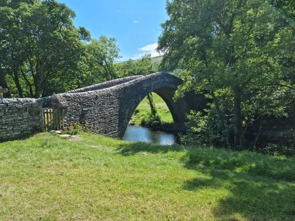
One then comes to the sixteenth century Ivelet Bridge, one of the most iconic (and photographed) bridges in the Yorkshire Dales. I was slightly disappointed not to find a headless black hound, but I was able to find the coffin stone which I have read about here. These flat, oblong platforms, at periodic intervals, served the specific purpose of providing coffin parties with the means of setting their burden down for a rest. It is quite clearly visible at the northern end of the bridge, now level with the ground. My guess is that it lost its height, and was incorprated into the surface when the road was mettled.

The iconic sixteenth century Ivelet Bridge

Stone coffin rest at Ivelet Bridge

After a lunch stop at Gunnerside, one heads along a wooded footpath along the side of the river (confessing here that I cut off a right angle, probably allowing the ease of modern footpaths to trump being purist about following the exact corpse path route. About half a mile east of Gunnerside, I came across confirmation that I was, literally, on the right track: quite clearly another stone coffin rest. An oblong, distinctly coffin-shaped platform, about six feet long and two feet broad. The archaeologist in me clocked that it was certainly worked stone, and had been put there deliberately (there are no other stones nearby) and it is aligned exactly with the path. Well well…

Stone coffin rest near Gunnerside
I felt it is a shame that these features which are of historical interest to the landscape and its past, aren’t marked. A small metal sign would do. If in the highly unlikely event that anyone from the Yorkshire Dales National Park authority reads this, please get in touch, I will be happy to work with you on this.
Another bit of flat floodplain walking brings you to the Isles Bridge, another iconic photo-op for the Dales. Some more easy walking – except for a section where the path goes along a rather hair raising raised narrow stone walkway, with no rails or anything. There is a section along the main road as it hugs the river before it curves north, and one rejoins the footpath along the leafy riverbank. And so, finally, to the Dales village of Reeth.

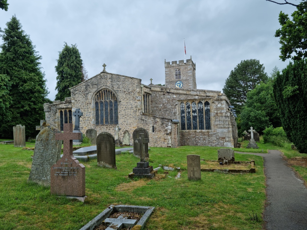
St Andrew’s Church, “The Cathedral of the Dales” at Grinton
The end of the path, the 12th century church of St Andrews at Grinton, is colloquially known as “the Cathedral of the Dales”. It is certainly a fitting end to the walk. In an interesting connection, the Dales Discovery site mentions that a certain Adam Barker, buried in the church, along with his daughters Sarah and Ann, was fined £5 for conducting a burial with a linen rather than a woollen shroud, contrary to local laws aimed protecting the woollen industry, and that this is recorded on a stone slab. I found Adam, Sarah and Ann’s interment stones, but not the slab.

Adam Barker, and his daughter Sarah’s interment slab at Grinton. Anna’s is just out of shot.
And one thing I noticed is that the churchyard is big – much, much bigger than would be needed for a tiny hamlet like Grinton, which makes sense.
All in all, even though I did not have a coffin to carry, the feel of the terrain, the grandeur of the Dale, and finding a few of the features I’ve read about and also discovering one or two more hiding in plain sight, certainly gave me a very small hint, perhaps a taste of the determination and sense of mission those which the coffin parties must have felt.
