
I’ve been moved to circle back to this long-neglected blog by this news story from the BBC, which reports on calls by a local MP to route the easternmost section of the Hadrian’s Wall Path along the actual route of the Wall through Newcastle’s West End. The 84-mile Path is one of sixteen officially designated National Trails, connecting Wallsend in the east to Bowness-on-Solway in the west (which is not the actual end of the Wall’s infrastructure). Currently, the eastern-most section follows the riverside path along the River Tyne through Newcastle’s urban landscape, rather than the actual line of the Wall through the the city’s West End. This is an interesting argument, from the point of view of spatial history and archaeology, and of cultural heritage interaction with historic landscapes – all subjects of professional interest to me. I also have a personal interest, having walked the whole Path myself in 2011. That’s another reason for this post in fact – I am currently self-isolating with Covid-19, which means I am hankering wistfully after the winds, views and fells of Northumbria even more than normal.
It is also an apt excuse to dig out some of the photos I took on the walk back then:
My guidebook for the walk, Hadrian’s Wall Path, by Henry Steadman (Trailblazer, 2009) wasn’t terribly complimentary about this section. It states it is “not the most auspicious start to the trail”, that it is “hemmed in by warehouses and the back of housing estates, there’s little industry, or indeed anything to see”. It also warns that “one or two trekkers have been subjected to insults and threats from local kids on both this stretch, and the one the leads across Denton Dene”. I have to say this was not my experience at all. On the contrary, I had nothing from cheery greetings from my fellow walkers, including one who noted my backpack and asked if I was going the whole way, and wished me luck.
In the diary I kept of my walk along the Path in 2011, I noted of this section:
Mile after rolling mile of city riverside, and out of town greenfield land do not perhaps quite herald the soaring, monumental fells to come in the way they might. But nonetheless, I think it is good to begin the walk with a cross-section through the modern landscape of the North East, a region built on coal and ships, the ghosts of which may be seen in the derelict and dilapidated steel yards and industrial estates which line the Tyne to the east.
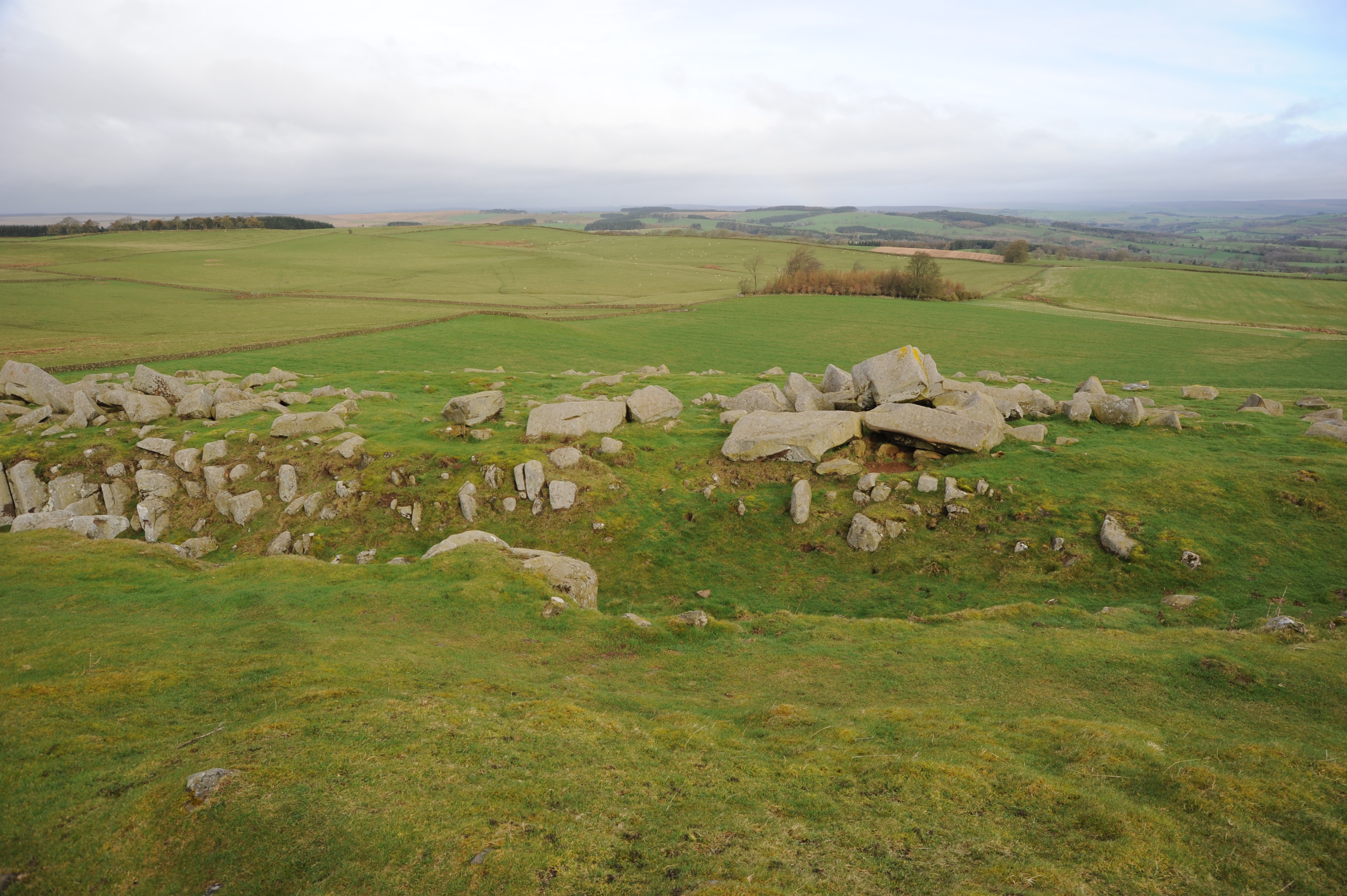
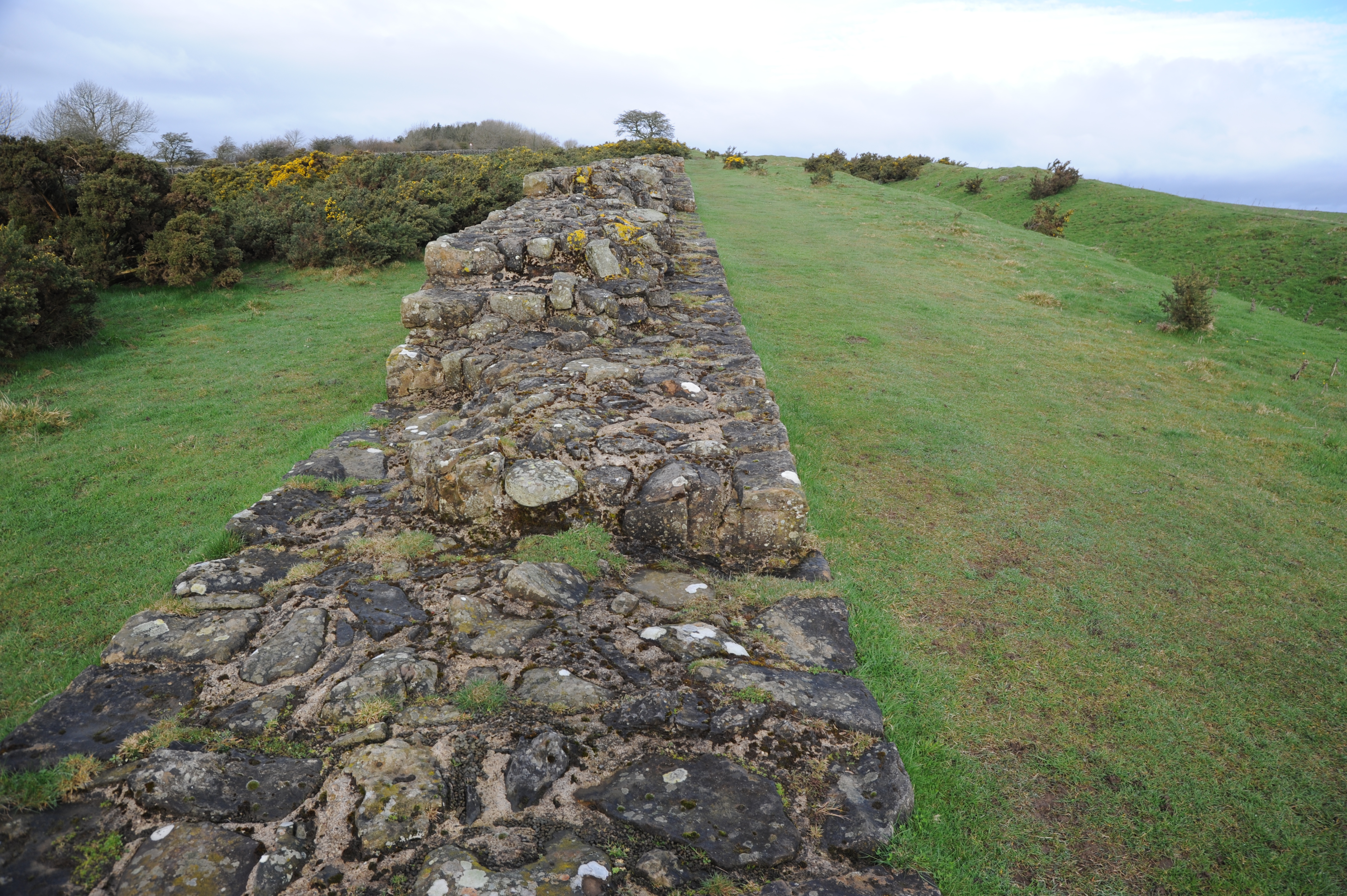
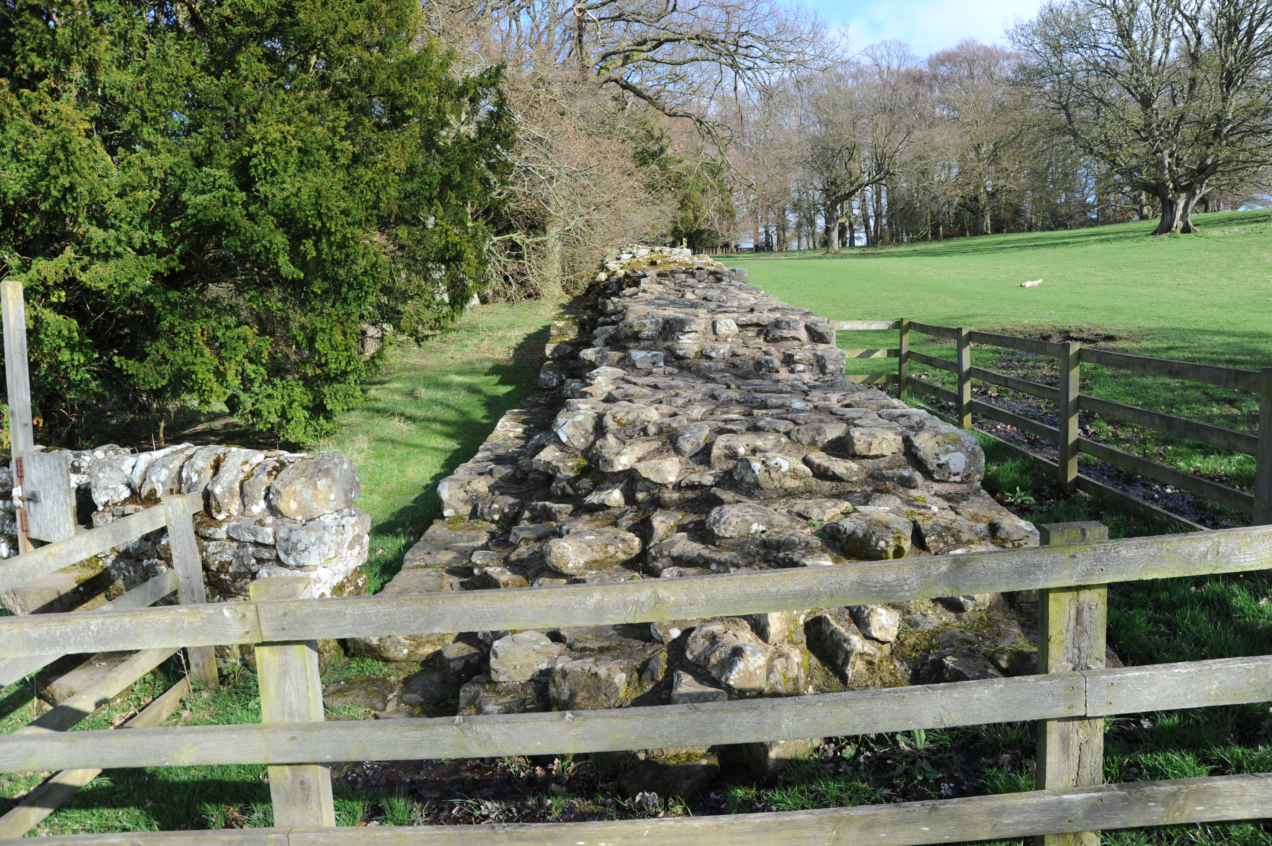
There is indeed a palimpsest of the modern story of Newcastle, stripped for sure of any heritage centre-type gentrification, but hinting at the spatial complexities of a 2000 year-old human-made landscape:
The route itself is a mishmash of river side paths, city Quayside, country footpaths and, in one stretch, the Wylam Waggonway, a dismantled former industrial mini-railway. It makes one think that when we plot ancient networks on maps, how much now-vanished complexity must we be overlooking in the process.
It is not a difficult walk, but the terrain throws you some curveballs as you leave the city:
For the last stretch, the path snakes up through a golf course… the trees are beautiful, all the more so in the dappled sunshine that made it through the hail bursts this afternoon. Shortly thereafter the landscape springs some pretty hairy – and rocky – gradients on you, as the path leaves the river and up towards Heddon-on-the Wall. As if to say “you’ve had it easy for now matey, *this* is a taste of what’s coming”.
Academic scholarship acknowledges that the Wall in the past is also the Wall in the present. As Claire Nesbitt at Divya Tolia-Kelley noted in their 2009 paper:
The Wall is monumental to unravelling narrations of civility, barbarism and imperial strategy, and has resonance with modern accounts of Empire, borders and national identity. It is not just a material for archaeological study, but an organic landscape through which historical, quotidian, geological and affective encounters are made and remembered.
Nesbitt and Tolia-Kelly, 385 [1]
So what do I think of the idea of re-routing the eastern section of the Path away from the Tyne? At first I thought it was a great idea: after all, there is a certain constructivist archaeological purity in routing the official trail along the monument, taking in sections exposed at roadsides and in back gardens. But then I had a better one: keep both routes. This would help stress that the Wall has always been a landscape and not “just” a line. A key part of Nesbitt and Tolia-Kelly’s argument is that the very linearity of the Wall is product of modern imperial perceptions of “inside” and “outside”, “civilized” versus “barbarian”, which did not apply in the northern Roman Empire. This is what the arbitrary line of a National Trail implies (the important arguments about conservation and curation of the monument aside). Keeping both routes would help stress that that landscape is a zone of engagement, not a neat line on a map.

That’s some interesting thinking and it’s good to see constructive use of your covid time. I was sort of surprised that you said that ‘keeping out’ didn’t apply to the northern Roman Empire because I always thought that was exactly what it was for. Have I not been paying attention? Still, I think you’re right about keeping both routes in the national consciousness because it does tell you a lot about shifts of perception.
>
Maybe that was put a bit too strongly – “keeping out” was certainly part of the story, perhaps more so towards the end of the Imperial period, however it seems to be widely accepted now that for much of its life, the Wall infrastructure was as much about regulating, monitoring, taxing and settling, as much as fortifying. And in the western Cumbrian sections, they would probably have been as worried about the Brigantes to the south as the Caledonii to the north. The dominant stress on the “inside/outside” dichotomy is very much a nineteenth/twentieth century preoccupation.